PulseAugur
中
实时 16:56:23
English(EN) FEMA’s maps undercount the U.S. flooding risk by about 6 million homes — and some of those maps are two decades old

FEMA洪水地图低估美国600万户家庭的风险

FEMA的洪水地图严重低估了美国的洪水风险,一项估计表明,实际面临风险的家庭比官方认定的多出600万。这些地图通常已过时,未能考虑未来的气候预测或个别房产的脆弱性。研究人员通过考虑潜在洪水深度、建筑物的年龄和状况、当地流动性以及维修成本和保险覆盖范围等财务因素,开发了一种更全面的洪水风险评分。 AI

排序理由 文章讨论了一个主要政府机构对洪水风险的严重低估,影响了数百万处房产,并强调了改进风险评估方法的必要性。

在 Fortune 阅读 →

AI 生成摘要 · Google Gemini · 来自 1 个来源。 我们如何撰写摘要 →
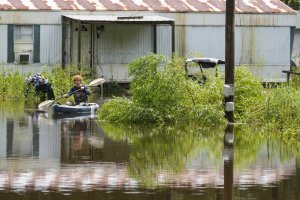
FEMA洪水地图低估美国600万户家庭的风险

本文如何被排名

Signal score
1 / 100
Composite score across the factors below. Higher = stronger signal that this story matters right now.
Newsworthiness bucket
Research
文章讨论了一个主要政府机构对洪水风险的严重低估,影响了数百万处房产,并强调了改进风险评估方法的必要性。
Source corroboration
Single-source cluster
Only one publisher covered this so far. Single-source stories can still rank when the publisher is high-authority, but they lack cross-source corroboration.
Topics
other
Editorial topic classification. Feeds into how the story surfaces on /topic/<slug> hub pages and into the per-entity coverage mix.
AI-industry relevance
Low
Off-topic or adjacent — cluster remains reachable but doesn't surface in AI-industry rankings.
Story freshness
Breaking (< 6h)
Fresh story with cross-source coverage still developing. Ranking may shift as more sources report.

完整方法见我们的编辑标准。

报道来源 [1]

  1. Fortune TIER_1 English(EN) · Yilei Yu, Dylan Connor, James R. Elliott, The Conversation ·

    FEMA 的地图低估了美国约 600 万户家庭的洪水风险——其中一些地图已有二十年历史

    Most homeowner’s policies don’t cover flood damage.