PulseAugur
实时 22:39:00
English(EN) What’s behind Beijing’s seabed mapping east of Taiwan?

中国绘制台湾东部海域海底地图,强化战略主张

中国首次在台湾东部进行了海底测绘调查,涉及多个海事机构。此次行动旨在收集该区域的详细水文数据,专家认为这可能增强潜艇和反潜能力。中国官媒认为此次调查是中国在宣示对台湾周边水域管辖权方面的战略进展。 AI

排序理由 文章详细描述了一个主要国家采取的一项重要的地缘政治行动,涉及战略测绘和潜在的军事影响。

在 SCMP — Tech 阅读 →

AI 生成摘要 · Google Gemini · 来自 1 个来源。 我们如何撰写摘要 →
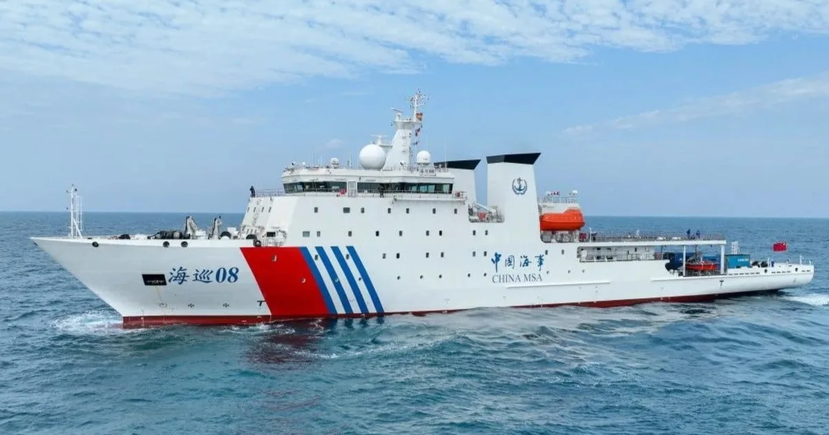
中国绘制台湾东部海域海底地图,强化战略主张

本文如何被排名

Signal score
0 / 100
Composite score across the factors below. Higher = stronger signal that this story matters right now.
Newsworthiness bucket
Research
文章详细描述了一个主要国家采取的一项重要的地缘政治行动,涉及战略测绘和潜在的军事影响。
Source corroboration
Single-source cluster
Only one publisher covered this so far. Single-source stories can still rank when the publisher is high-authority, but they lack cross-source corroboration.
Topics
policy, other
Editorial topic classification. Feeds into how the story surfaces on /topic/<slug> hub pages and into the per-entity coverage mix.
AI-industry relevance
Low
Off-topic or adjacent — cluster remains reachable but doesn't surface in AI-industry rankings.
Story freshness
97 days old
Aged out of breaking-news scoring windows; ranking reflects the durable signal from the full source set.

完整方法见我们的编辑标准

报道来源 [1]

  1. SCMP — Tech TIER_1 English(EN) · Albee Zhang ·

    北京在台湾东部进行海底测绘的背后是什么?

    Beijing has completed a seabed survey in the complex waters east of Taiwan, its latest move to strengthen management of the waters around Taiwan following maritime border talks between Japan and the Philippines, according to state media. It is the first time mainland Chinese mari…