PulseAugur
实时 06:30:47
English(EN) Lunastadt Devlog: Expanding the Strategic Map with NASA Satellite Imagery https://youtu.be/mf-7q9p_IIY Over the past day, we made one of the most noticeable vis

Lunastadt 游戏更新战略地图,采用 NASA 卫星图像

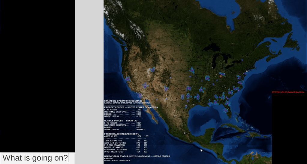
游戏 Lunastadt: The Invasion from the Moon 已通过集成 NASA 卫星图像获得了显著的视觉升级。此次更新提供了更详细、更逼真的战略地图,增强了游戏规模和军事指挥界面的可信度。开发人员精心将现有的游戏元素(如城市节点和军事地点)与新的高分辨率地形数据对齐,以确保一致的体验。此外,为进行测试,国际地图已扩展到主要入侵区域之外,尽管游戏的核心重点仍然是入侵美国。 AI

排序理由 视频游戏的产品更新。

在 Mastodon — fosstodon.org 阅读 →

AI 生成摘要 · Google Gemini · 来自 1 个来源。 我们如何撰写摘要 →

Lunastadt 游戏更新战略地图,采用 NASA 卫星图像

报道来源 [1]

  1. Mastodon — fosstodon.org TIER_1 English(EN) · [email protected] ·

    Lunastadt Devlog: Expanding the Strategic Map with NASA Satellite Imagery https://youtu.be/mf-7q9p_IIY Over the past day, we made one of the most noticeable vis

    Lunastadt Devlog: Expanding the Strategic Map with NASA Satellite Imagery https://youtu.be/mf-7q9p_IIY Over the past day, we made one of the most noticeable visual upgrades yet to the strategic map in Lunastadt: The Invasion from the Moon . Until now, the map worked well enough a…