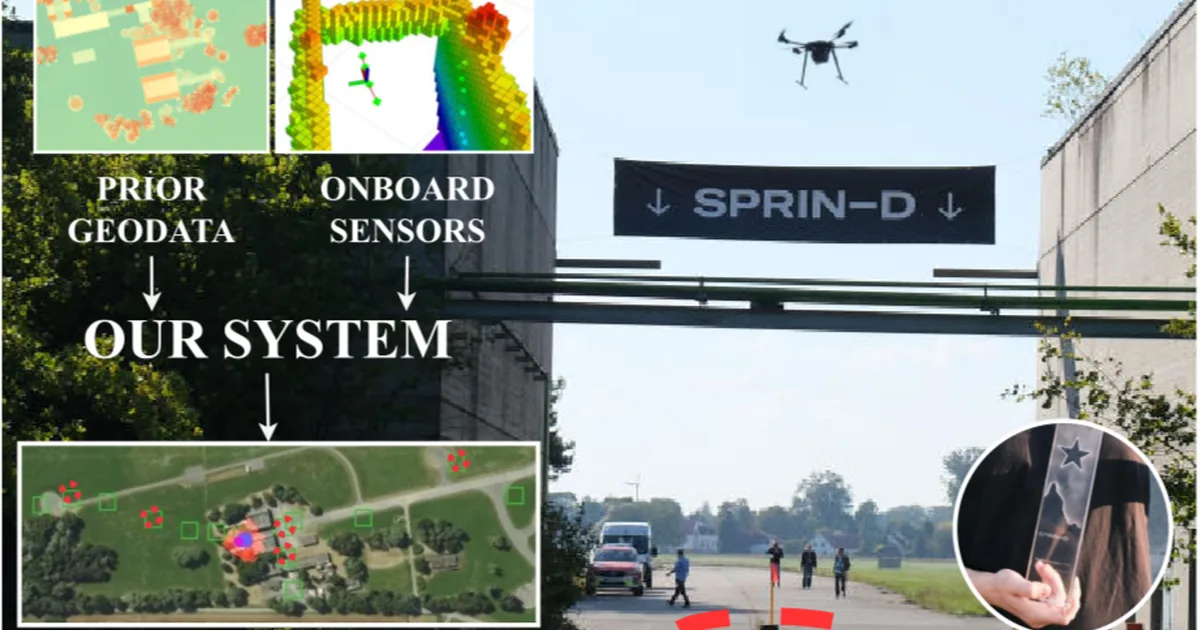
A Czech team developed a novel system for long-range drone navigation in GPS-denied environments, winning the SPRIN-D Funke challenge. The system uses a clustered particle filter to fuse LiDAR-generated heightmaps with prior geographical data, correcting for odometry drift without relying on GNSS. It successfully navigated kilometers through varied terrain on a CPU-only hardware setup, demonstrating significant improvements over standard odometry. AI
IMPACT Demonstrates advanced AI techniques for robust drone navigation in challenging, real-world conditions, potentially impacting autonomous systems in logistics and surveillance.
RANK_REASON The article details a specific technical achievement in drone navigation for a competition, focusing on the methodology and results. [lever_c_demoted from research: ic=1 ai=1.0]
- Czech Technical University in Prague
- FlightForge
- GNSS
- Intel NUC i7
- LiDAR
- OpenVINS
- SPRIN-D Funke
- YOLOv8
AI-generated summary · Google Gemini · from 1 sources. How we write summaries →