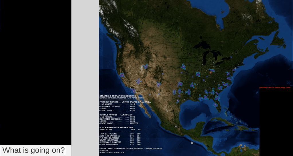
The game Lunastadt: The Invasion from the Moon has received a significant visual upgrade with the integration of NASA satellite imagery. This update provides a more detailed and realistic strategic map, enhancing the believability of the game's scale and military command interface. The developers meticulously aligned existing game elements like city nodes and military locations with the new high-resolution terrain data to ensure a cohesive experience. Additionally, international mapping has been expanded beyond the primary invasion theater for testing purposes, though the game's core focus remains on the invasion of the United States. AI
RANK_REASON Product update for a video game.
Read on Mastodon — fosstodon.org →
AI-generated summary · Google Gemini · from 1 sources. How we write summaries →