PulseAugur
EN
LIVE 01:44:05

Location encoders improve AI satellite image analysis

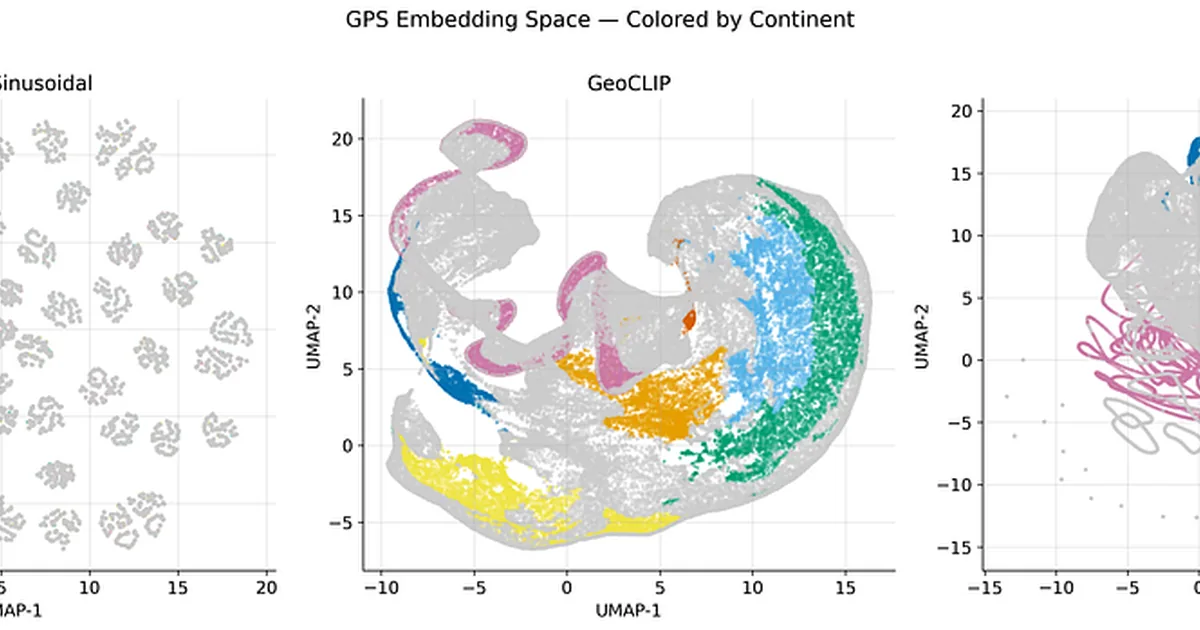
A new benchmark study explores how to best incorporate geographic location data into AI models for satellite image analysis. Researchers tested three methods—naive sin/cos, GeoCLIP, and SatCLIP—to encode latitude and longitude, finding that while naive sin/cos produced the most geographically coherent embeddings, SatCLIP offered a better balance for land-cover classification. The study used a DINOv2 vision model and the EuroSAT dataset to evaluate the effectiveness of these location encoders. AI

IMPACT Incorporating location data can significantly improve AI's ability to classify satellite imagery, moving beyond pixel analysis to understand geographic context.

RANK_REASON The cluster describes a research paper evaluating different methods for encoding geographic location data for AI models. [lever_c_demoted from research: ic=1 ai=1.0]

Read on Towards AI →

AI-generated summary · Google Gemini · from 1 sources. How we write summaries →
Location encoders improve AI satellite image analysis

How we ranked this

Signal score
0 / 100
Composite score across the factors below. Higher = stronger signal that this story matters right now.
Newsworthiness bucket
Tool
The cluster describes a research paper evaluating different methods for encoding geographic location data for AI models. [lever_c_demoted from research: ic=1 ai=1.0]
Source corroboration
Single-source cluster
Only one publisher covered this so far. Single-source stories can still rank when the publisher is high-authority, but they lack cross-source corroboration.
Topics
paper, product
Editorial topic classification. Feeds into how the story surfaces on /topic/<slug> hub pages and into the per-entity coverage mix.
AI-industry relevance
High
Clearly on-topic for AI-industry coverage.
Story freshness
130 days old
Aged out of breaking-news scoring windows; ranking reflects the durable signal from the full source set.

Full methodology in our editorial standards.

COVERAGE [1]

  1. Towards AI TIER_1 English(EN) · Amrith Coumaran ·

    Does GPS Help AI See Better? Testing Location Encoders for Satellite Imagery

    <p>You’re looking at a satellite image. Green, trees, maybe a river. Forest? Farmland? Wetlands? Without knowing <em>where</em> this is, even a human would struggle. A pine forest in Sweden and a eucalyptus plantation in Brazil look nearly identical from 700 km up.</p><p>This is …