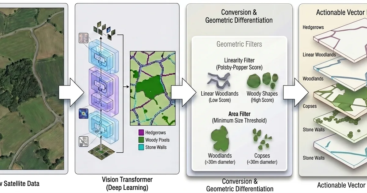
Google AI has developed a high-resolution deep learning framework to identify and map fine-scale ecological features like hedgerows and copses, which are often missed by standard satellite imagery. This new vectorized dataset, an advancement from their previous raster-based Farmscapes 2020 map, transforms these features into an actionable inventory. The framework addresses challenges in spatial topology, semantic classification, and computational scale to provide data that can aid in landscape restoration and carbon accounting without compromising food security. AI
IMPACT Enables more precise land-use planning and conservation efforts by making previously invisible ecological features actionable.
RANK_REASON The item describes a new deep learning framework and dataset for ecological mapping, which falls under research and development in AI for environmental applications. [lever_c_demoted from research: ic=1 ai=1.0]
Read on Google AI / Research →
- Charlotte Goodall
- England
- Farmscapes 2020
- Google AI
- Google Research
- Leverhulme Centre for Nature Recovery
- Michelangelo Conserva
- S2-cell
- UK
- University of Oxford
AI-generated summary · Google Gemini · from 1 sources. How we write summaries →